Precision Commercial Aerial Services: Surveys, Photography, Videography
Strategic Aerial Intelligence for Michigan
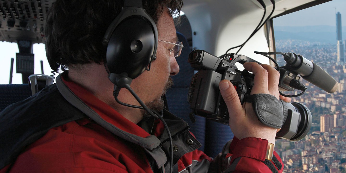
Detroit Helicopter Charters provides advanced aerial survey capabilities across Michigan, leveraging the unparalleled maneuverability and low-altitude flight characteristics of helicopters. This allows for precise data acquisition for critical applications such as magnetometer and electromagnetic surveys, LiDAR mapping, and comprehensive GIS data integration. Our specialized aerial services extend to professional cinematography and photography, where we facilitate optimal camera positioning, including door-off operations for handheld precision, or the integration of advanced gyro-stabilized platforms for cinematic-grade imaging. We deliver bespoke solutions tailored to capture intricate details and comprehensive perspectives for any commercial or scientific project within the region.

Aerial
Surveys
LiDAR, GIS Maps, FLIR, HD Video & More
Detroit Helicopter Charters delivers comprehensive aerial solutions for critical infrastructure management, encompassing detailed pipeline surveys, Right-of-Way inspections, and transmission line patrols across Michigan. We ensure the provisioning of specialized aircraft equipped with the necessary instrumentation to execute projects with unparalleled accuracy and efficiency, supporting essential maintenance and integrity programs.
High Tech Results
The Top Pilots in Michigan, Today's Technology... Maximum Results.
Call 313-913-1688 Now!
Detroit Helicopter Charters provides the tools needed to complete your land surveys, utilizing the right equipment to provide the aerial photos that are often needed.
Precision aerial surveys streamline complex Right-of-Way and site inspections, facilitate meticulous acquisition of topographical data, and capture high-definition imagery for critical commercial projects across Michigan. Helicopters provide an optimal platform for comprehensive terrain assessment, enabling detailed inspection of pipeline networks for anomalies, efficient detection of transmission line infrastructure issues, and thorough aerial photography and videography of expansive properties. Detroit Helicopter Charters specializes in developing bespoke photographic and remote sensing operations, meticulously tailored to maximize both technical efficacy and financial efficiency, ultimately delivering superior project outcomes.
Helicopters represent the definitive platform for precise aerial surveying due to their inherent ability to operate at significantly lower altitudes and airspeeds compared to fixed-wing aircraft. While Federal Aviation Administration regulations mandate a minimum of 1,000 feet above the highest obstacle for fixed-wing operations, helicopters can maneuver safely at much lower elevations, enabling superior detail acquisition. This unparalleled operational flexibility also permits direct inspection of challenging or hazardous zones, providing engineers and project managers with critical perspectives otherwise unobtainable, thereby enhancing data quality and operational safety for complex surveys.
There is no better way to conduct your visual survey, animal population counts, soil drainage analysis, ROW inspections, pipeline and transmission line inspections, and geographical surveys.

LiDAR Imaging
Light Detection and Ranging, or LiDAR, is a remote sensing method used to examine and measure Michigan topography as well as objects, like vegetation, upon it.

Infrared Imaging
Thermographic IR cameras are used to detect radiation in the long-infrared range of the electromagnetic spectrum and produce images of that radiation, called thermograms.

HD Video Gimbal Capture
Modern HD and 4K cameras can be mounted to helicopters, using the proper STCs, with a gimbal to stabilize photos & videos for detailed results.
Cutting-Edge Aerial Filming and Professional Videography
For expert camera work in the Detroit Sky
Get a Fast, free QuoteDetroit Aerial Cinematography
Detroit Helicopter Charters delivers comprehensive resources for professional-grade aerial cinematography across Michigan, providing access to cutting-edge technology for custom productions. This includes sophisticated gyro-stabilized camera mounts such as Tyler Mounts, Wescam, Cineflex, Pictorvision, and SpaceCam, integrated with high-performance specialty cameras like Cineflex HD, RED Epic, and Arri Alexa, alongside advanced 3D and experimental camera systems. We support diverse production requirements, from dynamic air-to-air sequences to precise ground-to-air shots, ensuring all aspects align with your creative vision. The operational teams are adept at collaborating intimately with aerial directors of photography and directors to translate artistic concepts into visually compelling results. Specializing in helicopter support for both still and motion photography, Detroit Helicopter Charters facilitates an extensive array of media-related operations throughout Michigan, encompassing feature films, television productions, documentaries, promotional videos, commercials, aerial prop deployment, critical relief work for broadcast networks, and comprehensive coverage of historical and major sporting events, utilizing a diverse fleet of specialized helicopters to meet exacting production standards.
Call Us Today at 313-913-1688 for a Free Quote
Contact Us
Aerial Photos
Hand-held or Mounted OpTions in Detroit
We will help you get the right equipment for your aerial photography project! Call 313-913-1688 today to get a fast, free quote.
The Most Options for Photography
Michigan's unique geographical features and architectural landscapes are optimally captured through professional aerial photography, delivering unparalleled visual content. Detroit Helicopter Charters specializes in provisioning bespoke aerial photography charters engineered to meticulously translate your specific visual objectives into high-resolution imagery. We provide flexible operational solutions, including the option for door-off helicopter configurations to facilitate handheld photographic precision for various projects. For applications demanding superior stabilization, advanced gyro-stabilized camera mounts are available, ensuring critical sharpness and compositional integrity. This commitment to technical excellence and tailored service provides a strategic advantage for commercial and artistic endeavors requiring sophisticated aerial imaging within Michigan.
Superior Service
Every one of our customers gets a dedicated helicopter expert to assist with flight plans, tech loadouts, production logistics, project schedules, and other demands.
Over 500 Aircraft
Our network of direct air partners extends well beyond Detroit, Michigan. This allows us to offer a wide range of solutions for even the most sophisticated projects.
The Best Equipment
From high-tech sensors like LiDAR, FLIR, and GIS to HD cameras and movie production gimbals, we're here to make your job as easy as possible.